Solutions
Case Name: UAV Automatic Inspection Programming Summer Camp
Target audience: Junior High School (13-16 years old)
Teaching objective: To control unmanned aerial vehicles to simulate coastal ecological monitoring tasks through Python programming, learn geographic coordinate calculation, sensor data collection, and environmental data analysis, and cultivate computational thinking and social responsibility.
1. Background of the case
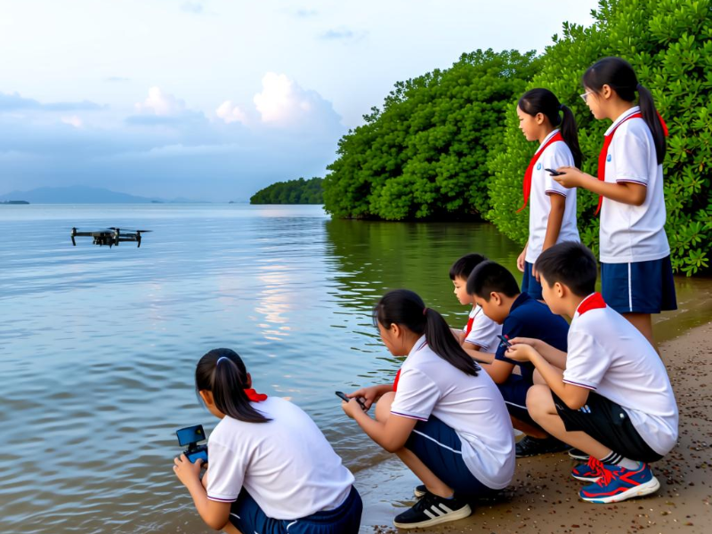
Using the mangrove forest on the west coast of Shenzhen as the monitoring area, students from class38, Junior High School,BaoAn District Experimental School,need to program and control the drone to fly along a preset route, automatically capture images of the coastline and record environmental data (such as temperature and humidity simulation data), and analyze the impact of human activities on the ecology. The case is connected to the "Algorithms and Data Processing" chapter in the Zhejiang Education Press Information Technology textbook, while incorporating knowledge of coastal zone protection from geography.
2. Core tasks and Python implementation
Task decomposition:
1. Map modeling: use Python's matplotlib library to draw a simplified two-dimensional map of Bao'an coastline, mark key coordinate points (such as mangrove area, mudflat area) and simulate obstacles (such as high-voltage line tower).
2. Path planning: Use the A * algorithm to avoid obstacles and generate the optimal inspection path (code reference MAVSDK Python's waypoint flight function).
3. Data collection: Simulate the sensors carried by drones to collect data.
4. Data analysis: use Pandas database to make statistics on the differences of simulation data in different regions, and generate a simple report (such as "the humidity in mangrove areas is significantly higher than that in mudflat areas").
3. Teaching Implementation and Results
Classroom organization:
Group collaboration: Three people work in groups, serving as "navigation algorithm engineers," "data collectors," and "environmental analysts," respectively, to strengthen team division of labor.
Virtual real integration: First, test the code logic through AirSim simulation, and then use SenseDrone for real flight verification (to reduce costs and risks).
• Learning outcomes:
Students have mastered programming basics such as geographic coordinate conversion and loop control, and are able to visualize data (such as using Matplotlib to draw temperature, humidity, and heat maps).
By analyzing simulated data, write an ecological proposal for the Bao'an coastline to cultivate a sense of social responsibility.
4. Localized extension
Red Education: Adapted the task as "Aerial Tour of the Bao'an Anti Japanese Base Site" and designed a flight route in conjunction with the discipline of history.
Smart City: Simulate unmanned aerial vehicle inspections of community illegal buildings, introduce OpenCV to recognize building changes (requires expansion of image processing module).
Interdisciplinary integration: integrating information technology, geography, and biology disciplines, in line with the requirements of Shenzhen's "new curriculum reform".
• Social value: In line with the construction of Shenzhen as an "ocean center city", enhance students' sense of local identity.
CATEGORIES
CONTACT US
Tel: +65 96463534
Email: info@dronesenseai.com
Add: 55 Ayer Rajah Crescent #07-05, Singapore 139949